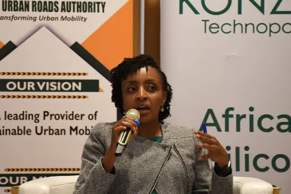
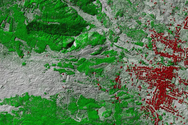
Patricia graduated from Nairobi University with a Bachelors degree in Geospatial Engineering and proceeded to University of Florence, Italy, to pursue a Masters degree in Geomatics & Natural Resources Evaluation. She completed her PhD at Kenyatta University and the focus of her research was modelling the spatial relationship between built-up volume densities and surface urban heat islands. Patricia is a full member in the Institution of Surveyors of Kenya (ISK) in the Geospatial Information Management Surveyors Chapter. She is also the Managing Director at Seyari Geoconsult where she offers consultancy services in the geospatial field.
Patricia has worked in various organizations as a GIS Technician at the International Committee of the Red Cross (ICRC), a Sales Team Leader and GIS Analyst at Oakar Services Ltd, and as a Surveyor at Geoacre Surveys. She is currently a lecturer at Kenyatta University in the School of Engineering and Architecture, Department of Spatial and Environmental Planning. She privately consults on land surveying, remote sensing, and GIS applications and services. Additionally, she is a researcher, with interests related to air quality and the effects of climate change in urban landscapes, as well as the dynamics of land use and land cover on urban populations and the environment.

This has been an annual event that started in 2022 where she co-hosted online discussions on pertinent issues on Africa’s climate agenda. The project seeks to bring together African leaders to discuss pertinent issues affecting the continent and putting us at the forefront on seeking global solutions.

This is a project that brought together DAAD Alumni from 14 African countries for a training on Digital technologies in environmental education at Kenyatta University. The training was done in collaboration with Prof. Christian Dorsch, Prof. Detlef Kanwischer and Prof. Tefsaye Tafesse.

This is a NIHHIS-CAPA citizen science urban heat island (UHI) mapping campaign in Nairobi. The project entails collecting data on air pollution and air temperature to determine the impact of these variables on health. The project will be done in collaboration with Prof. Vincent Onywera and Prof. Kevin Lanza.
1. Karanja, F. N., & Mwangi, P. W. (2023). “Advanced Remote Sensing for Sustainable Decent Housing for the Economically Challenged Urban Households”. In Sk. Mustak, Dharmaveer Singh, & Prashant Kumar Srivastava (Eds.), Advanced Remote Sensing for Urban and Landscape Ecology (1st ed., pp. 63–82). Singapore: Springer. https://doi.org/10.1007/978-981-99-3006-7_3
2. W. Mwangi, “Developing Smart Cities to Combat Climate Change”. ISK Surveyors Journal, December 2023. http://isk.or.ke/surveyorsjournal2024/#p=19
3. Sahay, Samraj, Patricia Mwangi, Karl Schultz, Laura Helmke Long, Ousmane Seidou, Hamidou Diawara, Imane Saidi, Iskander Erzini Vernoit, and Ahmed Rachid El-Khattabi.. “Assessment of GGA Options Identified in the UNFCCC Compilation and Synthesis Document.” IPAM and Adaptation Leader, November 2023.
https://unfccc.int/sites/default/files/resource/ReportGGATP_final.pdf.
4. Mwangi, P. W., Karanja, F. N., Kamau, P. K., and Letema, S. C.: “Contribution Index of Land Cover and Land Surface Temperature Changes in Upper Hill Nairobi, Kenya”, ISPRS Annals of the Photogrammetry, Remote Sensing and Spatial Information Sciences, V-3-2021, 141–149, https://doi.org/10.5194/isprs-annals-V-3-2021-141-2021, 2021
5. Ongoma V., Mwangi, P.W., “The loss of vegetation is creating a dangerous heat island over Nairobi”, The Conversation, (2020, December 8), https://theconversation.com/the-loss-of-vegetation-is-creating-a-dangerous-heat-island-over-nairobi-150622
6. Mwangi, P.W., Karanja, F.N., Kamau, P.K., and Letema, S.C., “Impact of Urban Forms on 3D Built-Up Intensity Expansion Rate from Aerial Stereo-Imagery”, ISPRS Annals of the Photogrammetry, Remote Sensing and Spatial Information Sciences, vol. 4, no. 1, 2020, pp. 203-208.
7. Mwangi, P.W., Karanja, F.N., and Kamau, P.K., “Analysis of the Relationship between Land Surface Temperature and Vegetation and Built-Up Indices in Upper-Hill, Nairobi”, Journal of Geoscience and Environment Protection, vol. 6, no. 1, 2018, pg. 1-16.
8. Wayumba, R., Mwangi, P., and Chege, P., “Application of Unmanned Aerial Vehicles in Improving Land Registration in Kenya,” International Journal of Research in Engineering and Science (IJRES), vol. 5, no. 5, 2017, pp. 05-11.